Thursday, May 10, 2012

Anchorage, Alaska


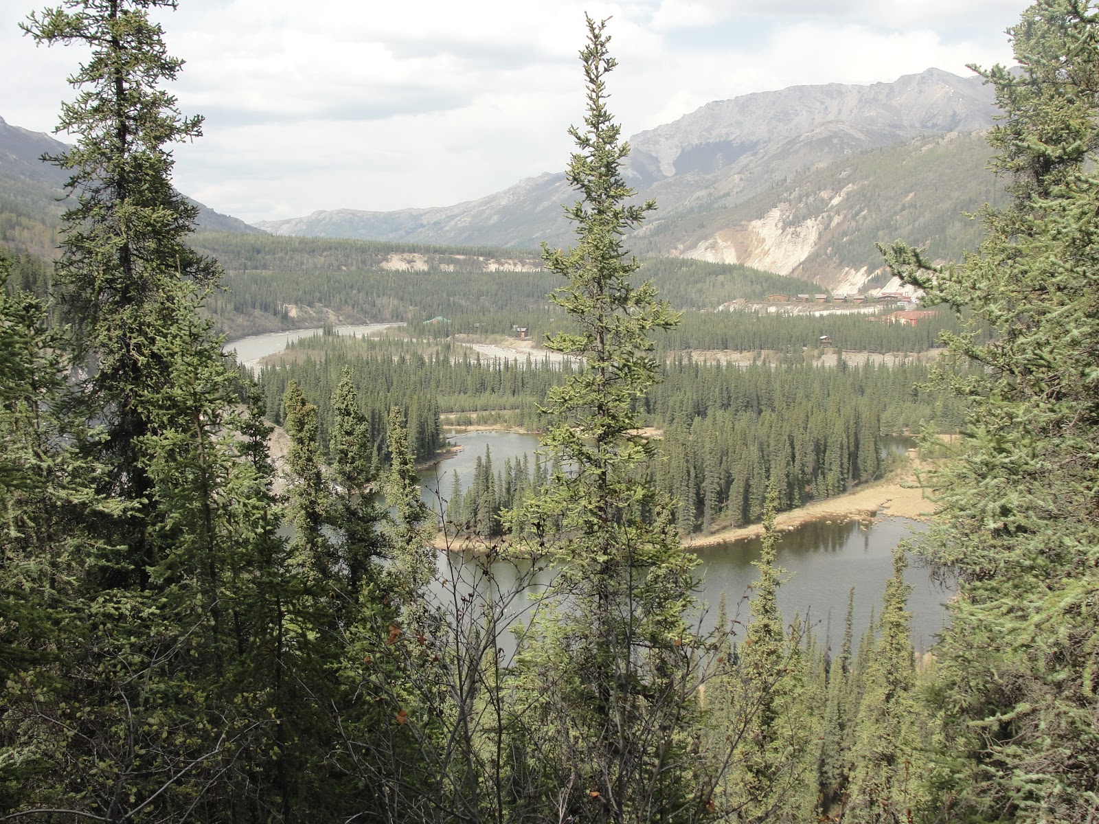
Kyle and I got to Anchorage by way of the Alaska Railroad. We were lucky to get free tickets to the train since we were employed by Aramark in Denali National Park. We enjoyed roaming the streets of Anchorage. By the time it got dark, we decided to bar hop. I believe the last bar closed at 4 a.m. Well, knowing us you know that we are frugal and didn’t want to pay for a hotel room. We ended up going to a hotel and sleeping for a while in the coat closet in the basement. I didn’t sleep well because I was scared that someone would find us! We tried sleeping in the lobby on the coaches but the security guard wasn’t too happy with us. We enjoyed Anchorage and the train ride to get there.


291, 826 residents in 2010: Alaska’s largest city.

The city is on a strip of coastal lowland and extends up the lower alpine slopes of the Chugach Mountains.

The city’s seacoast consists mostly of treacherous mudflats. Unwary victims have walked onto the solid seeming silt revealed when the tide is out and have become stuck in the mud.

The Coastal Trail: The trail is 11 miles in length. It follows the Anchorage coastline from Downtown Anchorage to its present at Kincaid Park.

Wednesday, April 4, 2012

Denali National Park and Preserve

Denali is an amazing place. I worked there as a hiking guide during the summer of ’10.

located in Interior Alaska and contains Denali (Mt. McKinley), the highest mountain in North America

The word “Denali” means “the high one” in the native Athabascan language and refers to the mountain itself.

The mountain was named after president William McKinley by a local prospector, although McKinley had no connection with the region. The name is only used by those outside of Alaska.

Charles Sheldon took an interest in the Dall sheep native to the region, and became concerned that human encroachment might threaten the species. After a visit, he petitioned the people of Alaska and Congress to create a preserve for the sheep.

1. Dall Sheep
2. Moose       

3. Grizzly Bears
4. Gray Wolf
5. Caribou
6. Red Fox
 7. Denali (Mt. McKinley)
A clear view of the mountain is only possible about 20% of the time during the summer. The mountain is 20,320 feet tall.

8. Polychrome Overlook

9. Sled dog kennel: These are the only sled dogs in the United States that help protect a national park and the wildlife, scenery, and wilderness therein, and it has been this way since the park’s beginning. They do a free dog sled demonstration. Get on a free bus from the visitor center.


 10. Flight seeing tour/glacier landing


11. Horseshoe Lake
 12. Savage River

 13. Alaskan Railroad


 Vehicle access: The park is serviced by a 91-mile road from the George Parks Highway to the mining camp of Kantishna. Only the first 15 miles of the road are available to private vehicles. I recommend taking a bus tour to Wonder Lake which is a 6 hour bus ride from the Wilderness Access Center. The tours travel from boreal forests through tundra. Rivers and glaciers are visible on the bus tour.
Hiking: Trails in Denali are largely centered around the Denali Visitor Center. Here is a list of trails near the visitor center.

1.       Rock Creek Trail

2.       Mt. Healy Overlook Trail

3.       Triple Lakes Trail

4.       Taiga Trail

5.       Spruce Forest Trail

6.       Morino Trail

7.       McKinley Station Trail

8.       Horseshoe Lake Trail
9.    Savage River Loop

Friday, March 30, 2012

Yellowstone National Park


established by the U.S. Congress and signed into law by President Ulysses S. Grant in 1872

located primarily in Wyoming, although it extends into Montana and Idaho

Yellowstone Lake is one of the largest high-altitude lakes in North America and is centered over the Yellowstone Caldera, the largest supervolcano on the continent.

Half of the world’s geothermal features are in Yellowstone.

In 1988, nearly 1/3 of the park was burnt by large forest fires.

1. Old Faithful Geyser: Eruptions can shoot 3,700 to 8,400 gallons of boiling water to a height of 106 to 185 feet lasting from 1.5 minutes to 5 minutes. Intervals between eruptions can range from 45 to 125 minutes.

2. Grand Canyon of the Yellowstone: The canyon is approximately 24 miles long, between 800 feet and 1,200 feet deep and between one quarter of a mile and three quarters of a mile wide.

3. Lower Yellowstone River Falls: The lower falls are 308 feet high, or almost twice as high as Niagara. The lower falls is the largest volume major waterfall in the Rocky Mountains of the United States. The volume of water flowing over the falls can vary from 63,500 gallons per second at peak runoff to 5,000 gallons per second in the fall.


4. Mammoth Hot Springs


Friday, March 23, 2012

Boulder, Colorado

Boulder is a special place. I have been there many times since I was born and raised in Denver. Many of my friends went to school there. When I was in college, I took my Wilderness First Responder course in Boulder. We got hands-on experience in Chautauqua park.

Boulder is located at the base of the foothills of the Rocky Mountains at an elevation of 5,430 feet.

In 2010, the population was 97,385.

1.       University of Colorado: Colorado’s largest university, commonly referred to as CU. In 2010, the university consisted of nine colleges and schools and offered over 150 academic programs and enrolled 29,952 students.


2.       Chautauqua Park: Originally established in 1898 to bring culture to rural areas, this beautiful park now hosts cultural events, features rock climbing sites, lovely gardens and picnic areas and is the starting point for many hiking trails.


3.       Eldorado Canyon: popular rock climbing spot, 6 miles south of Boulder.

4.       Flatirons: rock formations near Boulder, consisting of five large, numbered Flatirons. The Flatirons were named by pioneer women after the flat, metal irons used to press their clothes. They are popular destinations for hikers and rock climbers, with rock grades ranging from 5.0 to 5.14.


5.       Pearl Street Mall: 4-block long pedestrian mall that celebrated its 30th anniversary in 2007. There are many street performers in the summer.


6.       Celestial Seasonings Tea Factory

7.       Boulder Falls: Scenic waterfalls plunging more than 70 feet into Boulder Creek.


Friday, March 9, 2012

Steamboat Springs, Colorado


Steamboat is home to natural hot springs. Settlers believed that the hot springs were actually a steamboat coming down the river. When settlers saw that there was no steamboat, and that the sound was coming from the hot springs, they decided to name the town Steamboat Springs.

There is something for everyone in Steamboat no matter the season. There is skiing, snowshoeing, hot springs, and cross country skiing in the winter. There is hiking, tubing, kayaking, and camping in the summer.

1.       Fish Creek Falls: The falls are located about 2 miles from town. It is a 260 foot drop. The parking is $5. There are picnic tables and hiking trails. There is a short easy hike to see the waterfall. From there you can continue on a trail that goes up in elevation.


2.       Strawberry Park Hot Springs: These hot springs are located in the hills, 7 miles out of town. It features two pools and natural rock features. Clothing is optional. It costs $10 each.

3.       Steamboat Ski Resort: A year-round resort offering winter and spring skiing on 141 trails. There is hiking and biking in the summer.

4.       Rabbit Ears Pass: This is a mountain pass to the south of Steamboat. It is called Rabbit Ears Pass because there are two rocks at the top of the mountain that look like rabbit ears.

5.       Howelsen Ski Area: Oldest ski area in continuous use in Colorado. It also serves as an Olympic training site. The winter carnival features fireworks and flare runs. Night tubing and ski jumping occurs here.  

6.       Downtown: The downtown area features many great restaurants, coffee shops, and stores.

7.       West Lincoln Park: This park is located along the Yampa River. It features a small pond and playground area for kids.

8.       Old Town Hot Springs: The hot springs are located downtown. It features multiple pools and two slides.

Friday, February 17, 2012

Canyonlands National Park

Canyonlands National Park preserves a colorful landscape eroded into canyons, mesas, and buttes by the Colorado River and its tributaries. The rivers divide the park into four districts: The Island in the Sky, the Needles, the Maze, and the rivers themselves.
The Island in the Sky is the most accessible district, offering expansive views from many overlooks along the paved scenic drive. The Needles offers more of a backcountry experience, requiring some hiking or four-wheel driving. The Maze is a remote district requiring considerably more time to visit.
Driving time to the visitor center from Moab is about 40 minutes.
On average 423,792 people visit the park each year.
1. Mesa Arch: .5 miles roundtrip, 30 minutes A mild walk out to an arch perched right on a cliff edge. Start the hike at Mesa Arch parking lot.